How did the North American continent, as we know it today, come to fruition? While maps can provide a static view of the landscape, the history embedded in those geographical representations is dynamic and multifaceted. The evolution of North America is a tale that stretches back hundreds of millions of years, encompassing dramatic geological shifts, climatic fluctuations, and complex continental interactions.
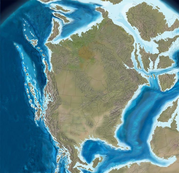
The formation of North America is a product of various geological processes, primarily driven by plate tectonics. Over 550 million years ago, much of the land that comprises today’s continent was submerged under a vast expanse of ocean. The supercontinent Rodinia was in existence during the late Precambrian, but it eventually fragmented, leading to the configuration of landmasses we recognize in the present era.
One of the most fundamental tectonic events affecting North America was the eventual rise of the Appalachian and Rocky Mountain ranges. The Appalachians, formed approximately 480 million years ago, were shaped through a series of collisions between tectonic plates. As continental drift forged new boundaries, these rugged mountains emerged from the ocean floor, significantly altering the landscape.
The Rocky Mountains, in contrast, are relatively younger, having been elevated following the collision of the North American Plate with various smaller plates, notably the Farallon Plate, roughly 70 million years ago. This volcanic and tectonic activity painted a different topography, distinguishing the eastern seaboard from the western landscape. But beyond mere formations, these geological features host unique ecosystems and climates, contributing to the continent’s biodiversity.
However, to truly grasp the relationship between maps and the North American continent is to explore the intricate connection between geological history and human interaction. Historical maps provide insights into how cultures evolved in response to changing environments. Indigenous peoples adeptly navigated and adapted to the diverse ecosystems long before European settlers arrived, exemplifying a profound understanding of sustainability.
In the context of colonial expansion, maps transformed from mere representations of land to tools of control. European settlers meticulously documented territories, often disregarding the established relationships indigenous people had with the land. This led to the displacement of native communities and an enduring colonial legacy that continues to impact societal dynamics today.
As societies advanced, the evolution of cartography paralleled technological advancements. The development of more sophisticated surveying techniques in the 18th and 19th centuries allowed for a more accurate delineation of boundaries. State lines, borders, and territories emerged not just as geographic markings, but as political constructs with significant ramifications for the inhabitants of those areas.
Contemporary maps utilize technology such as Geographic Information Systems (GIS) and remote sensing, which offer robust tools for analyzing spatial data. This technological evolution compels us to question: What narratives do these maps construct? Are they merely geographic tools, or do they also contribute to our understanding and responsibility towards the environment?
The era of industrialization brought profound changes to North America, as urban expansion and resource extraction began to encroach upon pristine landscapes. The introduction of railroads, roads, and later highways fundamentally altered the transportation network, symbolizing progress yet often at the expense of natural ecosystems. Maps of this era reflect human priorities, frequently overlooking environmental consequences.
The pristine wilderness depicted in early maps contrasts starkly with contemporary maps that illustrate fragmentation due to urban sprawl, deforestation, and resource depletion. This engenders an essential dialogue about land stewardship. How do we reconcile the histories embedded in our maps with the urgent necessity for sustainability? Navigating this intricate pathway involves a community of stakeholders from policymakers to local citizens, all engaged in the common goal of preserving natural habitats.
The implications of climate change further complicate these conversations. Rising sea levels, increasing temperatures, and extreme weather events pose significant threats across the continent. Coastal areas are particularly vulnerable as maps gradually illustrate land loss. It forces communities to reassess their relationship with geography. Are we prepared to adapt to a continually changing climate, or do we risk further detriment?
Moreover, maps can serve as a call to action. They depict not only peril but also opportunities for restoration. Conservation efforts aimed at rewilding areas, restoring wetlands, and improving biodiversity are vital in mitigating adverse effects of climate change. Geospatial analysis can pinpoint areas ripe for restoration, all while engaging communities in these rejuvenation efforts.
As we ponder the evolution of the North American continent through historical and contemporary maps, it becomes evident that this exercise transcends mere geography. It invites us into a broader challenge—how do we embrace our multifaceted heritage and confront the ethical responsibilities that come with it? This journey requires introspection, innovation, and most importantly, a collective commitment to sustainability.
In synthesizing our past with a future-focused mindset, we can utilize the lessons learned through cartography to promote harmony between human activity and nature. Hence, as we visualize North America on a map, we must also embrace our role as stewards of this intricate and invaluable ecosystem.